80 kilometers
Oberstdorf - Merano
3.200 Kilometers
Total length of the E5 from Brittany to Verona
2.996 Meters
Highest point: Pitztaler Jöchl
Alpine Crossing
Germany, Austria, and Italy
June to September
Best time to travel
Route & Itinerary
Stretching 3,200 kilometers (1,988 miles), the E5 is one of Europe’s longest and most celebrated long-distance hiking paths. Its most popular section leads from Oberstdorf in the Allgäu region, across Tyrol, to Merano in South Tyrol.
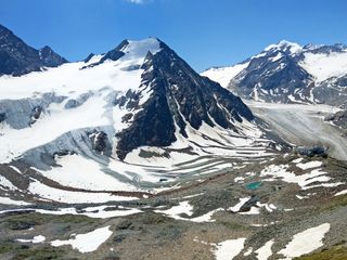
Over approximately 80 kilometers (50 miles), hikers traverse the main Alpine ridge—along panoramic high paths, dramatic gorges, narrow ridges, and alpine passes. Highlights include the suspension bridge at Holzgau, the ridge hike on the Venet, the high-alpine Pitztaler Jöchl (9,826 ft), and crossing the Timmelsjoch into Italy.
This route is challenging, demanding sure-footedness, a head for heights, and solid physical fitness. Several stages can be shortened using valley alternatives or public transportation.
Hiking Bliss on Our Most Scenic Tours
Hiking Bliss on Our Most Scenic Tours
Questions and Answers about hiking the E5
The E5 long-distance hiking path starts in Oberstdorf in Germany's Allgäu region and leads via Tyrol to Merano in South Tyrol.
Due to the altitude profile, our Hiking Tours on the E5 can be booked from June to September.
Our hiking tours on the E5 are assigned to our hiking types "Mountain Hiking" and "Trekking", and offer the ideal getaway in the alpine outdoors, especially for experienced mountain hikers with good stamina. Surefootedness, a head for heights, and proper hiking equipment are essential for these challenging hiking tours.
The total length of the E5 long-distance trail is approximately 3,200 kilometers. Our classic Alpine Crossing E5: Oberstdorf - Merano consists of six stages covering a total distance of 81 kilometers. Along the way, you will climb approximately 5,000–6,200 meters and descend 6,500–7,300 meters, making this tour a challenging but exceptionally scenic alpine adventure.
On the daily stages of our hiking tours along the E5, you cover between 9 and 15 kilometers per day.
On our hiking tours on the E5, you will stay in beautiful hotels and accommodations.
Your luggage is collected from your accommodation each morning between 8 and 9 a.m. and will be waiting for you at the next hotel in the evening (between 4 and 7 p.m.), allowing you to hike completely relaxed, carrying only light day packs.
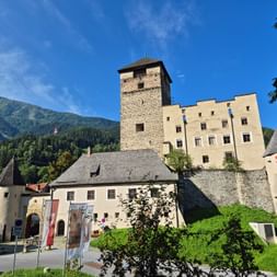

The Most Beautiful Places Along the E5
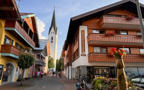
Oberstdorf
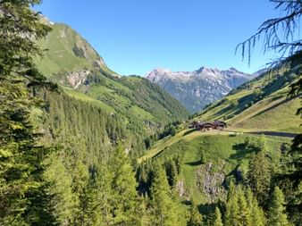
The Alpine crossing begins in the Allgäu region. Surrounded by towering peaks, this charming village is a popular starting point for mountain tours. Many hikers set off on the first stage of the E5 from here.
Holzgau
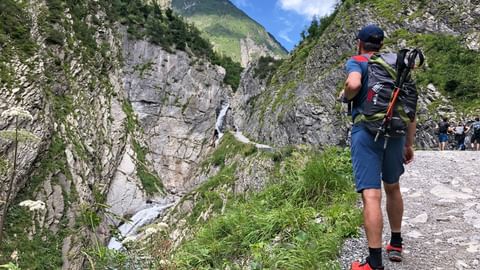
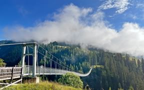
Nestled in the Tyrolean Lech Valley, Holzgau is the next stop after the ascent from Oberstdorf. The village is best known for its suspension bridge over the Höhenbach Gorge. At 200 meters (656 ft) long and 110 meters (361 ft) high, it is the longest bridge of its kind in Austria. For many hikers, crossing it becomes one of the most unforgettable moments of the first days on the E5.
Pitztal
After several days in the mountains, hikers reach the Pitztal. The crossing of the Pitztaler Jöchl at nearly 3,000 meters (9,826 ft) marks the highest point of the entire Oberstdorf-to-Merano route and leads directly into dramatic high-alpine landscapes.
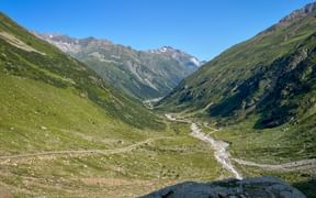
Ötztal – Timmelsjoch
From Vent in the Ötztal, the trail continues over the Timmelsjoch into South Tyrol. At 2,500 meters (8,202 ft), you cross the border into Italy. The pass offers sweeping views and is a highlight of the Alpine crossing.

Passeiertal
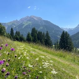
Beyond the Timmelsjoch, the Passeiertal unfolds. After the high-alpine passes, this section is gentler, with orchards, meadows, and quaint villages. The Southern influence of the landscape and culture becomes increasingly apparent.
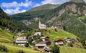
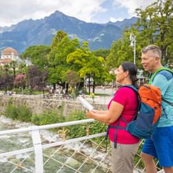
Merano
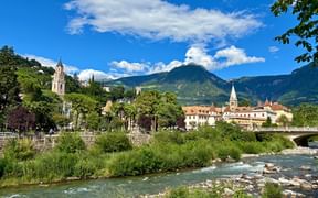
Merano marks the end of the E5 Alpine crossing. Situated at the transition from the Alps to the Mediterranean, the town welcomes hikers with a mild climate, a historic old town, and delicious South Tyrolean cuisine—an ideal reward after days in the mountains.
The Most Scenic Stages on the E5
14 Kilometers | ↗ 990 Meters | ↘ 900 Meters
From Oberstdorf, the route steadily climbs through the Sperrbachtobel to the Kemptner Hütte. After a short break, it continues to the Mädelejoch, where you cross the border into Austria. A long descent opens up stunning views of the Lech Valley. Finally, you reach Steeg, the stage town known for its brightly painted houses, via the suspension bridge at Holzgau.
↔ 15 Kilometers | ↗ 900 Meters | ↘ 1.100 Meters
From Steeg, the route follows alpine paths deeper into the Lechtal Alps. The climb leads to the Leutkircher Hütte, a traditional base for mountaineers. After a pause, the descent heads toward the Arlberg, reaching St. Anton, a well-known winter sports town that becomes a quiet and welcoming starting point in summer.
↔ 11 Kilometers | ↗ 350 Meters | ↘ 1.490 Meters
By train and cable car, the route first reaches Landeck, then continues up onto the Venet. The ridge trail provides sweeping views of the surrounding peaks. Two smaller summits lie along the way before the route winds through alpine meadows and forests into the Pitztal.
↔ 13 Kilometers | ↗ 1.250 Meters | ↘ 950 Meters
After a bus ride, the ascent begins to the Braunschweiger Hütte. From there, the trail climbs to the Pitztaler Jöchl (2,995 m / 9,826 ft), the highest point of the entire tour. The descent passes through the Rettenbachtal, where a bus or gondola can cover the final meters into the Ötztal. As an alternative to the high-alpine route, travelers can explore the Pitzenklamm and the picturesque Piburger See.
↔ 15 Kilometers | ↗ 1.000 Meters | ↘ 1.000 Meters
From Vent, the route follows historic passes toward the Timmelsjoch. At 2,500 meters (8,202 ft), the border into Italy is crossed. The descent leads through the Timmel Valley and down into the Passeiertal, where inns and hotels provide the first taste of South Tyrolean cuisine.
↔ 14 Kilometers | ↗ 1.490 Meters | ↘ 250 Meters
The final day begins with a stretch to the Pfandleralm, closely associated with the name Andreas Hofer. From there, the route continues along forest paths up to the Riffel. A high-altitude trail offers sweeping views of the Passeiertal and the South Tyrolean mountains. After a stop at the Hirzerhütte, a gondola takes travelers down to the valley, from where a bus carries them to Merano—the final destination of the Alpine crossing.
Why Choose to Hike the E5?
Crossing Borders
One path, three countries, diverse cultures.
High-Alpine Landscapes
Suspension bridge in Holzgau, ridge paths on the Venet, and alpine passes.
Mountain Hut Charm
Cozy stops in alpine huts and traditional inns.
Pure Alpine Crossing
From Germany through Austria to South Tyrol.
Varied Stages
From challenging and alpine to leisurely and scenic.
Travel Stories on the E5
E5: Your Benefits with Eurohike
Perfectly organized hiking tours
In Eurohike hiking vacations, you enjoy that extra level of service and comfort. From start to finish, our Eurohike travel specialists plan and organize your active vacation, giving you even more time to enjoy your active getaway. During your hiking tour, you can focus worry-free on what truly matters: the joy of hiking with your loved ones.

Comprehensive guidance from our travel specialists
Our experienced travel specialists are available to assist you at any time, both during the selection of your tour and throughout the booking process. Your wishes and concerns are our top priority, ensuring that your journey becomes the most beautiful time of the year.

Well-prepared travel information and route descriptions
All guests receive a comprehensive information package with detailed walking maps and travel documents including tips and information on culture, cuisine, country and people - tailored to the respective region and requirements of the individual walking tour. Every year, we review the route meticulously, and continually develop new variations that provide even more insights into the land and culture.
Accommodations with feel-good factor
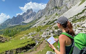
After a wonderful day of cycling, you will be welcomed in our carefully selected accommodations in the evening. We choose our accommodations with care and consideration, always with a focus on their special orientation towards active vacationers and opportunities for evening relaxation. You'll experience that extra level of comfort on our charming hiking tours, where you can enjoy even more feel-good facilities and an added touch of indulgence.

Hiking without luggage
With us, you'll enjoy the most comfortable form of active vacation. Eurohike transports your luggage to the next accommodation every day. Leave the hotel in the morning with ease, and by evening, your bags will already be waiting at the next lodging. Experience a completely carefree hiking adventure across Europe with our luggage transfer!

Personal on-site support
Our Eurohike original tours are characterized above all by the personal touch for which we have been known for many years. For our original tours, you will be personally welcomed by our team members at the arrival destination. In an informational meeting, all details about the tour and the itinerary will be explained. Our on-site team is also available for tips and recommendations.
Exploring the most beautiful routes with our on Tour-App
We invest a lot of time and effort in crafting our routes and meticulously review them regularly. Thanks to the Eurobike & Eurohike on Tour app, navigating the most beautiful cycling routes in Europe becomes child's play, ensuring you don't miss any of the highlights along the way.

Travelife-Certification
We are certified as a sustainable tour operator! Our green actions have been officially confirmed by Travelife - an international certification programme for sustainability management in the travel industry. We had to fulfil over 260 criteria in various areas: from environmental protection and energy-saving measures to emissions management and consumer protection.
Ready for Your Personal Hiking Adventure?
Whether you want to hike across the Alps, stroll along sunny coastlines, or discover Europe’s most beautiful islands—wherever your journey leads, we’ll help you find the perfect tour. Our team is happy to guide you toward your next unforgettable adventure!
Other Hiking Paths in Europe

Alpe-Adria-Trail
Three countries - countless experiences

Altmühltal-Panorama-Path
Hiking holidays without luggage in the alpine foothills

BergeSeen Trail
A hiking holiday without luggage on the BergeSeen Trail

Dachstein High Altitude Circular Trail
Hiking without luggage in the Dachstein region

St. Francis’ Way - La Via di Francesco
Pilgrimage hiking without luggage on the St. Francis Way

GR221 Trail Majorca
Mediterranean hiking happiness mountain adventure in Majorca

Way of St. James
Pilgrimage without luggage on the Way of St. James

King-Ludwig-Way
Hiking with luggage transfer on the King-Ludwig-Way

Lechweg Path
Hiking without luggage on the Lechweg Path

Malerweg Trail
Hiking without luggage on the Malerweg Trail

Merano High Mountain Trail
Hiking without luggage on the Merano High Mountain Trail

Moselsteig Trail
Hiking without luggage on the Moselsteig Trail

Rennsteig Trail
Hiking without luggage on the Rennsteig Trail

Rheinsteig Trail
Leisure hiking on the most beautiful hiking trail in Germany

Rota Vicentina
Coastal hiking and wonderful moments of tranquillity in Portugal

Salzalpensteig Trail
Hiking holidays with luggage transfer on the Salzalpensteig Trail

Tyrolean Trail
Hiking without luggage in the Wetterstein and Karwendel Mountains

Via Claudia
Hiking without luggage along the Via Claudia Augusta

World Heritage Trail Wachau
Hiking without luggage in the World Heritage landscape of the Wachau

If you have any questions about your hiking tour on the E5, I am here to help and advise you!
Friday: 9.00 am - 5.00 pm


